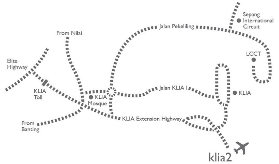
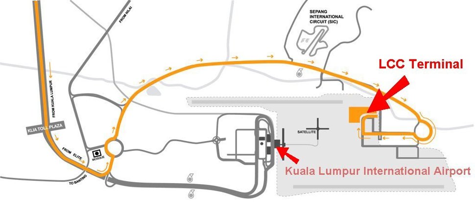
The Low-Cost Carrier Terminal (LCCT) is located about 20km away from the Kuala Lumpur International Airport’s Main Terminal Building (MTB). The primary road access from Kuala Lumpur is North Central Link Expressway (ELITE Highway), North South Expressway (PLUS Highway), KESAS Highway and Lebuhraya Damansara Puchong (LDP) Highway.
GPS Coordinates: Latitude: 2°44’13.41″N Longitude: 101°43’10.05″E
Read more on…
The LCCT is on the other side of the runway of KLIA, but you can’t walk between the two terminals.
The LCC Terminal offered shuttle bus service to link passengers from the LCC terminal to Main Terminal Building, KLIA and vice versa.
DISTANCE FROM LCCT:
- 19.7 km to KLIA Main Terminal
- 61.5 km to Terminal 3, Subang Airport via Shah Alam and ELITE Highway
- 75 km to KLCC via Seremban Highway & Jalan Tun Razak
- 66 km to 1 Utama via ELITE Highway & NKVE Damansara Exit
- 60.8 km to Petaling Jaya Hilton / Asia Jaya via ELITE Highway and Federal Highway
- 44.7 km to Putrajaya Boulevard (Precinct 3) Putrajaya


ABOUT LCCT
The LCC terminal is specifically designed to suit the Low Cost Carrier (LCC) business model where it would have no travellators, escalators, aerobridges and would be able to have a shorter turnaround time.
The 35,290 square meters LCC terminal comprised one single storey building for departure and arrival. It is designed to handle 10 million passengers a year and there is scope for further expansion should more airlines decide to use it.
Read more about what is LCCT.
External Links
- www.nomadicnotes.com – Airport Guide: Kuala Lumpur Low Cost Carrier Terminal (LCCT)